Distance: Saturday: 19 miles, Sunday: 14 miles
Date: 10-4-08 to 10-5-08
Gauge: 2.9
 We finally got in the trip we wanted to take a year ago on the Vermillion River. Unfortunately not as many people were able to go this year, three instead of eight. For everyone who was invited and didn’t make it; you missed a great trip, but we may do it again because it was such an awesome trip. Hopefully the weather will cooperate again.
We got a bit of a late start but made it to our starting point at Kickapoo State Park just west of Danville, IL while it was still light. There were more campers there than we expected for this time of year, but the tent camping area was totally separated from the RV area – yahoo, no slamming screen doors.
Unfortunately the Governor of Illinois in all his wisdom has decided that closing this park and several others is the way to make up for a budget shortfall. That’s a shame, it is a really nice park. We were kicking ourselves for not visiting sooner. Hopefully some way will be found to keep it open.
As we were pulling in to our spot we noticed the young couple next to us was having trouble with their tent. We had already decided to only use one tent and save time so we had ours up in about three minutes. They came over and asked if we could help them with theirs, as they were U of I students and had rented it from the university. After trying to get it together for a few minutes we decided they were missing a part. I offered them mine, but while I was gone to get it they found the other piece that and got it together.
Just before we left for an after-dark ride on the mountain bike trail a couple of raccoons got into a noisy scuffle at the edge of the woods. The guy next door came over to ask what the noise was, and if we thought they were vicious or dangerous. We told him they weren’t, but not to keep any food in their tent so they would not try to get to it.
Before hitting the trail we headed down toward the river to check out the water level at the put-in. It looked fairly low, like we might be walking quite a bit but it was hard to tell looking with our headlights. We had heard live music coming from that direction earlier in the evening so we stopped by to check that out for a few minutes as it was at the building right next to the put-in. Just three guys playing guitars & singing blues & bluegrass with about 50 people in lawn chairs listening, it was a really nice setting.
We headed back up the hill toward the bike trail. When we came upon a point on the trail where a tree had fallen and blocked the way we had to scout out a way around, a little tricky in the dark even with the lights - we couldn't tell exactly where the trail went on the other side. After a while the trail broke out of the woods and into a meadow. It kept getting smaller until we decided we were probably on a game trail instead of the bike trail, so we backtracked and found where we had missed a turn. We followed that for a short way until it apparently disappeared into another meadow. Since we really didn’t want to wander around all night we decide to go back the way we had come. After yet another wrong turn onto a trail that branched in and a few consultations with the GPS (good thinking bringing that along, James) we found the original trail. Riding at night was fun, but it definitely pays to have a headlight mounted on your helmet instead of on your bike.
While we were getting ready to sleep the guy next door asked James about the raccoons again, and asked if he thought they had any diseases. Trying to be as helpful as possible to someone who evidently had not spent much time outdoors James replied that he was pretty sure they did, so they should probably stay away from them. Some time later I heard our neighbors talking about the raccoons again; he said something about them trying to sneak up on their food, then it sounded like he threw something at them…pretty funny stuff.
In the morning when we got up James noticed they had moved their tent away from the woods…we decided they must have thought the extra 20 or so feet of open space would dissuade the raccoons from attacking.
After breakfast we went to the put-in, it was nice having it two minutes away. My parents arrived soon after so Dad could go with us and Mom could drive shuttle; that’s one really nice thing about going in that area. We packed up and got onto the water around 8:30. Fortunately it wasn’t as low as it had appeared the night before, we just had to get our feet a bit wet to get going. I think we only hit one spot all day where we had to walk for maybe 100 feet. It may have been a bit different if we had had canoes with us like last year, but they probably could have made it through most of the low spots.
Paddling through the park was spectacular. In a couple of weeks when the trees have turned it will probably be even better, but it was still gorgeous. We had a few riffles and trees to go around but there were also high shale bluffs and rock formations to see that really made it a great place to start a trip. At one point I noticed movement in the water under a branch that was partially submerged but I couldn’t tell what it was. As we got closer an animal jumped out of the water and ran up the bank – an otter. I was pretty excited as that was the first time I had ever seen one. About a half mile or so later James was coasting along when I saw a couple of heads pop out of the water about 20’ ahead of him. I asked him what they were, and he had not seen them – he was looking at his GPS. When I got up to the spot where they had been I past, climbed out of the water & rushed up over the top of the bank. That was pretty amazing to see three otters in one day.
 The rest of the way through the park and down to the halfway point was a mix of paddling along farmland and some more shale bluffs that were probably 300’ high. We passed several old railroad bridges and several abandoned bridge piers. One set of piers was solid brick. There were also a lot of bricks in the water. It doesn’t seem like they should have been around that long, but we wondered if they were leftovers from construction; it didn’t look like any piers had been demolished.
We followed a red-tailed hawk downstream for a while, until it dropped out of a tree into the water and caught a fish for lunch. Then it sat in a tree and ate while we passed by.
 Just before the halfway point for the day where we knew we would have to portage around a low-head dam we started to see warning signs to leave the river because of the dam. Several people have been killed in the past by going over the dam and getting caught in the current at the base. There is an access at Ellsworth Park which is a short paddle upstream on another fork of the river. Overall that would be about nine miles from where we put in and would make a really nice day trip.
We paddled on down toward the dam, keeping our eyes peeled so we didn’t get caught off guard by it. It turns out there is a lower section at river left where water flows continually, but we wanted to take out river right anyway because the topo map showed a really steep bank on the left. There are also abandoned bridge piers there, so it’s easy to tell it's time to get out. The water was about 6-8 inches below the dam on the right so we could also see it sticking up. We got out and found a portage route which went right behind the bridge pier. It involved handing the boats down a fairly steep bank, but was a lot shorter than walking along the bank until it dropped down again, that looked to be at least a quarter of a mile. I had the bottom end duty for the first boat, so while James and Dad went back for the next one I looked around. There was a fish ladder right at the base of the pier that we could have just walked down had we noticed it was there. This would only work if the water level is below about 3.5, because it was 2.9 on Saturday. If water was going over the dam you definitely would not want to try that route.
 We decided that was a good place for lunch, so we took a break for a while. There was a pretty nice maybe Class II riffle below the dam, as the river makes a sharp right, then a sharp left. There was also a sweeper on the outside of the left bend that we really wanted to stay out of, and it looked a bit rocky in a couple of places so we decided on a route & put the boats back in. The nice thing about sharp turns is the eddies that sometimes form on the inside edge. We were able to go through the rougher part, then eddy out on the inside to stay out of the strainer.
The next few miles were mostly along farm ground, with not a lot to see. We were amazed at the number of tires in the river; in a few places they seemed to be everywhere, buried in the bottom.
We didn’t see a whole lot of wildlife after that. It was just a nice leisurely paddle weaving with the channel to stay in enough water, and maneuvering around trees here and there. As we got closer to our ending point for the day at Forest Glen nature preserve we talked a bit about how the river is at the far end of the park, and it’s a pretty good walk from the main road so not many people go down there. Of course when we arrived there was a family of six on the sandbar.
We had talked to the ranger about camping in the meadow up on the bank, but after we looked around we decided to camp on the sandbar since there was a large pile of wood washed up by the river that we could use for fire wood, and we wouldn’t have to dig a fire put. And we figured the sand would be softer than the ground up on top as well.
While we set up camp the family of six left, but a teenage couple and a mother and young son arrived…so much for no one being around. We had planned to hike through the park a bit, but didn’t want to leave our gear unattended so we hung out on the sandbar, got a fire going and did some more reading.
There were a lot of deer tracks on the sandbar, so we weren’t surprised when three does and two yearling deer crossed the river downstream about 50 yards. They looked a little surprised to see us. When it was almost dark another one crossed the sandbar quite a bit closer, but I couldn’t get my light on it to see if it was a buck or another doe.
The sky after dark was amazing; very clear and you could see a ton of stars. Between that and the quiet it really spoils you for camping in any kind of campground. We also heard a couple of groups of coyotes howling, and an owl. After sitting outside for a while we started to get pretty cold, so we decided to turn in.
During the night I got really cold, so I put my fleece top back on. When I heard a blue jay I figured it was probably morning, but when I opened my eyes it was dark. It turned out I had gotten far enough down into my sleeping bag that it was over my head, and I had also pulled my hat down over my nose…it was really cold.
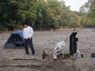 Fortunately we had embers left from the night before so it was easy to get the fire going and start warming up. Unfortunately there was a really heavy dew, so everything we had hung up to dry the night before was soaked. We rigged up a drying rack next to the fire & hung our clothes up while we worked on breakfast.
After a while everything except the tent was relatively dry so we packed up and headed out. We didn’t make it onto the water until almost 10, but we only had 14 miles to go, so we figured we could still make our estimated finish time of 2:30.
The first portion of this leg meandered through some more high bluffs, with some shale and sandstone areas. We noticed a couple of large birds flying toward us, and when they got close we could tell they were bald eagles, one of them still had some of it’s adolescent coloring on the bottom of its wings. We had been talking about the bald eagles we saw last year along the Wabash and weren’t sure if we would see any this year or not. Those were a real bonus after seeing the otters the day before.
The first portion of this leg meandered through some more high bluffs, with some shale and sandstone areas. We noticed a couple of large birds flying toward us, and when they got close we could tell they were bald eagles, one of them still had some of it’s adolescent coloring on the bottom of its wings. We had been talking about the bald eagles we saw last year along the Wabash and weren’t sure if we would see any this year or not. Those were a real bonus after seeing the otters the day before.
As the terrain along the river flattened out we encountered more wide areas of slow moving water. We also went through several bends with a lot of trees down in them that we had to dodge around; Dad said we were dancing with trees. It kept the paddling interesting, that’s for sure.


Not as much water here as he thought...or maybe just more rocks
After that we didn’t see much in the way of landmarks; the Eugene covered bridge probably being the most interesting.
 We hit a couple of shallow spots in the last half mile or so before the Wabash, but managed to slide through without walking. The Vermilion joins with the Wabash on the outside of a bend, so there is quite a sandbar to get through, but there was just enough water to make it.
 Once on the Wabash we only had about a mile to go. We didn’t have much chance to see the bottom, it is either much deeper or the water just isn't as clear. There was one area where our paddles hit bottom, but that was only for a very short distance. The wind was a factor on the first three-quarters of a mile or so, blowing pretty steady right in our faces. Once we turned east it wasn’t bad, that ran for another quarter mile or so then we just had another short leg upwind to the takeout.
The ramp is nice, although steep, and the DNR had enough sense to point it downstream so you can swing around behind it to take out. We arrived right at 2:30, pretty much on schedule.
 Over all this was a great trip, with really nice camping locations both nights, perfect weather and plenty of water. Hopefully the park won't close and we can do it again.
More pictures are here:
http://picasaweb.google.com/jnichols0516/OvernightPaddleOct2008#5254548275333483426


